Home and Latest News

Uncategorized

Virginia’s New Wildlife Action Plan
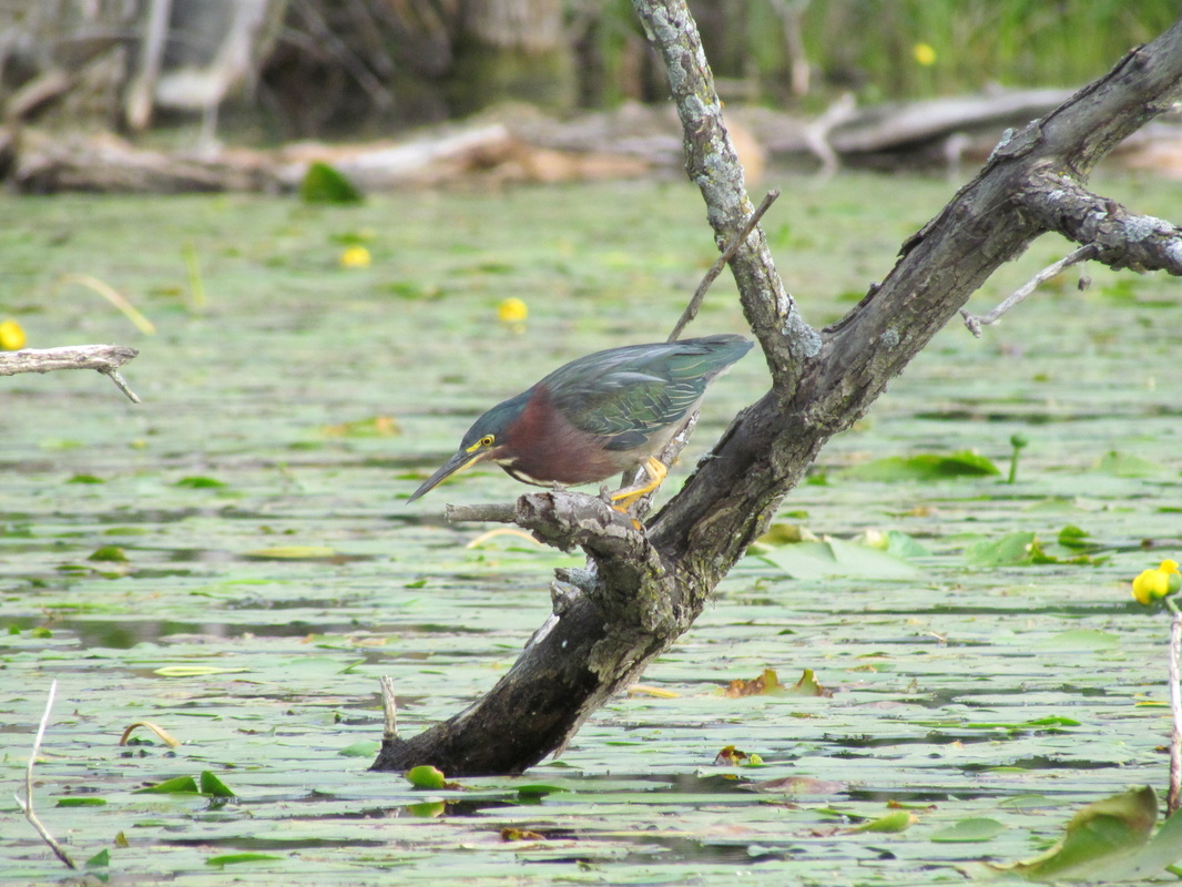
PictureGreen heron. Image from Virginia Department of Game and Inland Fisheries.

By Chris Burkett, Virginia Department of Game and Inland Fisheries

Why is it so Difficult to Restore Endangered Species?

In 1973, when President Nixon signed the Endangered Species Act (ESA) into law, the nation made a profound statement. We said that wildlife are a valuable American resource, and we don’t want to squander our natural heritage. For more than 40 years, the nation’s conservation community has been trying to live up to this ideal. However, as we’ve learned, endangered species conservation can be incredibly difficult, expensive, and have significant impacts on people, communities, and economies.

Part of the problem is that when you are dealing with an endangered species, by definition, there are very few individuals of a particular species with which to work. It can take a long time for a population to breed, raise young, and expand into new areas. At the same time, these populations must still deal with predation, disease, illegal activities, and genetic bottlenecks. Very often, these problems are compounded by a lack of suitable habitats. To address these issues, the ESA includes a number of funding options to help species recover. The ESA also includes regulatory tools to make sure that individual animals (and plants) aren’t killed illegally and that occupied habitats aren’t destroyed. It is these regulatory tools that often result in bitter conflicts between landowners, communities, businesses, and conservationists.

While the ESA has successfully conserved diverse species like bald eagles, American alligators, and grizzly bears, it’s implementation has also proven to be expensive, time consuming, and politically contentious.

Is There a Better Way to do Things?  

Beginning in the 1990s, after the political battles over northern spotted owls, snail darters, and gray wolves, many conservationists began asking if we are doing the right things regarding endangered species. The intent wasn’t to undermine the ESA but, rather, to find a more effective way to manage these species in ways that were not so expensive or injurious to people and communities. After years of discussion and debate, the consensus was that the best way to deal with endangered species is to keep species from becoming endangered in the first place. If you can keep healthy populations in healthy habitats then regulations might not be required and the conflicts can be avoided.

Working with Congress, the 56 state and territorial wildlife agencies, the U.S. Fish and Wildlife Service, and thousands of conservation partners hit upon an idea; a Federal-State-Private partnership to keep species from becoming endangered. At the core of this effort is each state’s Wildlife Action Plan that identifies the species of greatest conservation need, the habitats they require, the threats impacting these species and habitats, and actions that can be taken to address those threats.
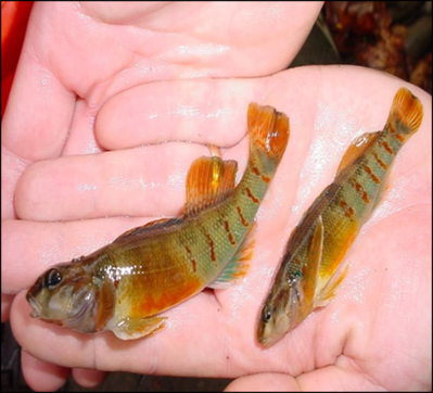

PictureDarters. Image from the Virginia Department of Game and Inland Fisheries.

Virginia’s New Wildlife Action Plan 

Working with a host of partners, the Virginia Department of Game and Inland Fisheries (DGIF) has been creating a new Wildlife Action Plan (Action Plan) that is locally relevant and actionable. The new plan includes chapters for 21 multi-county planning regions in Virginia that are roughly analogous to Virginia’s Planning District Commissions. Each chapter identifies local priorities for species, habitats, threats and conservation actions. This Action Plan tries to address diverse issues including habitat fragmentation, climate change, and water pollution. Finally, this new Action Plan tries to find ways to conserve wildlife while also doing good things for people. We hope that the Action Plan will inspire greater collaboration among the existing conservation community while also helping DGIF work more effectively with partners, communities, and landowners. 

Some of the most important actions we can take involve conserving and restoring the quality of our water. Over 65% of our Action Plan species are aquatic and live in rivers, wetlands, and caves. These species become threatened when the quality of our riparian and upland habitats is threatened allowing sediment and other pollutants to flow into adjacent aquatic systems. In addition to impacting our rivers, the loss or degradation of our riparian and upland forests, shrublands, and grasslands also threaten the other 35% of Action Plan species that rely upon these terrestrial habitats. Water is also critically important to communities for drinking water, recreation, agriculture, and economic development. It is possible for us to do good things for wildlife while doing good things for people.

Are There Opportunities for Master Naturalists?

It is our hope that the Master Naturalist chapters will find conservation opportunities within this Action Plan. With your training and connection to the local communities, there are many ways that chapters can contribute towards implementation. Opportunities could range from contributing to riparian forest restoration to helping document the success of conservation actions, or contributing to national efforts documenting the status of species such as bumble bees or monarch butterflies. Finally, much of this information will be new to communities, and master naturalists are ideally suited to help local officials understand how they can make the best use of this Action Plan. The opportunities are nearly endless, and we look forward to exploring them with you.

The draft 2015 Wildlife Action Plan is available on DGIF’s website at: http://www.bewildvirginia.org/wildlife-action-plan/draft/. It will be presented to the Virginia Board
of Game and Inland Fisheries during their August meeting after which it will be submitted to the U.S. Fish and Wildlife Service for final approval. 

Virginia’s New Wildlife Action Plan Read Post »
Uncategorized

Facilitating Science and Conservation Through Collaboration

Collaborative Science is the product of a research grant entitled ‘Sustaining ecological communities through citizen science and online collaboration.’ This research is supported by the National Science Foundation and is intended to help engage individuals in using technology to conduct locally based, but regionally connected, natural resource stewardship projects. Collaborative Science uses a series of web-based modeling and social media tools to engage Virginia Master Naturalists in conducting authentic science. This includes making field observations, engaging in collaborative discussions, graphically representing data, and modeling ecological systems. The goal of these efforts is to allow volunteers to engage in natural resource management and conservation. 

Collaborators in this project include learning scientists, ecologists, and computer and information scientists from several higher education institutions, including Rutgers University’s Program in Science Learning, Virginia Tech’s Department of Forest Resources and Environmental Conservation, Colorado State University’s Natural Resource Ecology Laboratory, the University of Massachusetts, and Virginia Master Naturalist volunteers. 

The results from this project will help to build and assess a collaborative science learning system as a tool to teach citizens about authentic scientific inquiry and how these citizens can become citizen scientists by engaging in authentic and necessary scientific practices.

Below, we share examples of some of the Collaborative Science projects VMN volunteers are leading.


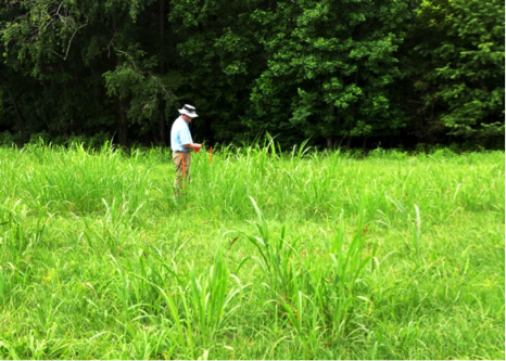
PictureStaking out the study site. Photo from VMN-Blue Ridge Foothills and Lakes Chapter.

Sample Project – Booker T. Washington Native Plantings Experiment

Text by Rick Watson, Blue Ridge Foothills and Lakes Chapter

The Blue Ridge Foothills and Lakes Chapter recently launched a Collaborative Science project at Booker T. Washington National Monument (BTWMN).  Project volunteers will localize and eradicate invasive grasses, e.g., Johnson grass, from a 15 by 30 meter area within a primarily fescue grass field at BTWNM.  Efforts will involve spot herbicide treatments in mid/late summer, followed by restoration planting in that area with three different mix types of native grasses (e.g., Big/Little Bluestem, Switch grass, Indian grass) in the fall.  Spring and summer growth will then be assessed by volunteers in May and September of the following year.  The goal is to determine which native grass mix, if any, competes most effectively with, and thereby deters, the Johnson grass invasive, thus providing park personnel with key information on how they might restore the monument fields to ecological conditions typical of those in the late 1800s.

A mini-grant, courtesy of the National Science Foundation project, is covering herbicide, seed, and other materials costs.  Twelve volunteers participated in an online facilitated web-based building of a project model that successfully highlighted all the elements that could impact the project plan.  This model, along with key technical guidance from the BRFAL Chapter Advisor, was used to guide the detailed project plan design.   The site was assessed and a proposed study area approved by BTWNM management.  The test area was then marked off and staked and the first herbicide treatment conducted July 15th.  Results from the study will be documented in the Collaborative Science website, where others may learn and apply it.


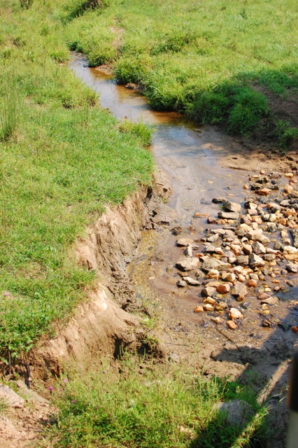
PictureDegraded stream at Bundoran Farm, prior to the project activities.

Sample Project – Improving Water Quality at Bundoran Farm

Text by Mary Tillman, Rivanna Chapter

Rivanna Master Naturalists on Bundoran Farm wanted to improve the water quality in the Chesapeake Bay by improving water quality in their own back yard, the Middle Branch of the Hardware River.  

A year ago when we joined a training on collaborative science, we decided to apply what we learned to Bundoran Farm, a 2300 acre preservation development where the goals are to use best practices in protecting the environment, maintaining the viewshed, and preserving farmland. Cattle, horses and sheep graze on the extensive pastures which allows Bundoran to fulfill its mission to support agriculture. Unfortunately the cows also use the streams to cool themselves and to defecate. The run off from the pastures as well as livestock contamination of the streams has contributed to water pollution in both our watershed and ultimately in the bay. It stood to reason that if we could deny the animals direct access to the streams and provide them with an alternative water source we might be able to eliminate sources of pollution here on the farm as well as throughout the larger watershed. The collaborative training helped us do just that.

The training taught us how to develop and implement solutions to problems in a new way. Rather than creating an outline where one step follows another, we learned to think more dynamically, not censoring or ordering in a linear way, but freely generating all obstacles or challenges that we thought we might encounter. Instead of making lists we wrote these obstacles onto balloons or satellites that rotated around a core where we had written a brief statement of our project. In our case it was “fencing livestock out of streams.” We also connected obstacles that were related.

Bundoran Farm has many individuals and groups who needed to support the project if we wer
e going to be successful. They were the homeowners who would be affected by the fencing of their property, the farmers who used the land for their livestock, the employees who worked for the developer, the Farm Management Committee who would ultimately recommend either for or against the project to the Board of Directors, and the developer himself. Each of these groups received their own balloon in the planning process and had to be approached differently in order to get them on board. In addition to the groups with vested interests in the project, we had other obstacles to overcome.


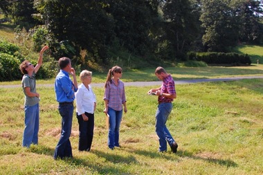
PictureThe Bundoran Farm Collaborative Science team checks out the site.

The well being of the cattle was an important consideration. Once we fenced the livestock out of the streams we had to find other sources for water. We needed to dig at least one well, run pipes from the well to various fields, and provide water troughs with cement pads. We also were concerned about making sure that the animals had access to shade. Each of these ideas got a balloon.

Another concern was how we would demonstrate that our project really did improve water quality. We did this by teaching ourselves to test for E. coli bacteria. We used James Beckley’s presentations on You Tube as a learning tool, bought the materials we needed, and set up and implemented a schedule for testing.

Probably the most important consideration was funding for the project. We worked with the Thomas Jefferson Soil and Water Conservation District whose aims were similar to ours, and we became one of their largest projects. Besides providing the fencing, piping, water troughs, gates and a well, they drew up a fencing plan that encouraged farmers to rotate their cattle on a more regular basis. Bundoran Farm benefitted from a TJSWCD grant that covered 100% of the costs.

When we completed our fencing project, we were left with 35 feet of pasture on each side of the streams that was no longer available to cattle. This riparian buffer, required by the project, helps to filter impurities out of the streams as they flow though the farm. The presence of the buffer has given us a unique opportunity to create an educational trail that follows the stream through a variety of habitats—open pasture, a fresh water marsh, woodland and a lake. Each habitat attracts different kinds of flora and fauna throughout the year.  What we want to do now is build a trail that makes use of the buffer to educate the residents of the farm, school groups and Master Naturalists. We hope to use the collaborative science model to help us realize this next goal.


Other on-going Collaborative Science projects include a study by the Historic Southside Chapter of the most effective methods for managing Japanese stiltgrass within a longleaf pine ecosystem and a multi-chapter investigation of varying methods of deterring house sparrows from nesting in bluebird boxes.  In particular, this group is investigating the efficacy of swapping sparrow eggs with fake plastic or wooden eggs in order to dupe the birds into wasting time and energy tending a nest that will never result in fledglings.  As all these projects are improving understanding of natural resources and contributing to conservation efforts, researchers also are learning about how the volunteers learn and use online tools throughout the Collaborative Science process.

Facilitating Science and Conservation Through Collaboration Read Post »

Uncategorized

Registration Open for 2015 Regional Conferences

Central Region: Saturday, August 29 at Holiday Lake 4H Center, Appomattox, VA
The central region includes Alleghany Highlands, Rockbridge, Central Virginia, Central Blue Ridge, Central Piedmont, James River, Rivanna, and Headwaters chapters

Phase 1 – Early Registration (June 29 – July 5)
Open to Chapter Liaisons and Conference Volunteers 

Phase 2 – Restricted Registration (July 6 – July 26)
Registration open to chapter volunteers, with limited space per chapter

Phase 3 – Regional Registration (July 27 – August 9)
If space allows, registration will open to any VMN in the Central Region

Phase 4 – Statewide Registration (August 10 – August 16)
If space allows, registration will open to any VMN in the state 

Registration Closes for All on August 16

Southeast Region: Sunday, August 30 at Airfield 4H Center, Wakefield, VA
The southeast region includes Riverine, Pocahontas, Historic Rivers, Historic Southside, Peninsula, Tidewater, Eastern Shore, and Northern Neck chapters

Phase 1 – Early Registration (June 29 – July 5)
Open to Chapter Liaisons and Conference Volunteers 

Phase 2 – Restricted Registration (July 6 – July 26)
Registration open to chapter volunteers, with limited space per chapter

Phase 3 – Regional Registration (July 27 – August 9)
If space allows, registration will open to any VMN in the Southeast Region

Phase 4 – Statewide Registration (August 10 – August 16)
If space allows, registration will open to any VMN in the state 

Registration Closes for All on August 16

Southwest Region: Saturday, September 26 at Hungry Mother State Park, Marion, VA
The southwest region includes Holston Rivers, Beagle Ridge, New River Valley, Roanoke Valley, Blue Ridge Foothills and Lakes, and Southwest Piedmont chapters

Phase 1 – Early Registration (July 27 – August 2)
Open to Chapter Liaisons and Conference Volunteers 

Phase 2 – Restricted Registration (August 3 – August 23)
Registration open to chapter volunteers, with limited space per chapter

Phase 3 – Regional Registration (August 24 – September 6)
If space allows, registration will open to any VMN in the Southwest Region

Phase 4 – Statewide Registration (September 7 – September 13)
If space allows, registration will open to any VMN in the state 

Registration Closes for All on September 13

Northern Region: Sunday, September 27 at Skyland Resort, Shenandoah National Park, Luray, VA
The northern region includes Old Rag, Shenandoah, Banshee Reeks, Fairfax, Arlington Regional, Merrimac Farm, and Central Rappahannock chapters


Phase 1 – Early Registration (July 27 – August 2)
Open to Chapter Liaisons and Conference Volunteers 

Phase 2 – Restricted Registration (August 3 – August 23)
Registration open to chapter volunteers, with limited space per chapter

Phase 3 – Regional Registration (August 24 – September 6)
If space allows, registration will open to any VMN in the Northern Region

Phase 4 – Statewide Registration (September 7 – September 13)
If space allows, registration will open to any VMN in the state 

Registration Closes for All on September 13

Registration Open for 2015 Regional Conferences Read Post »

Uncategorized

Now Recruiting VMN Volunteers for RareQuest Project

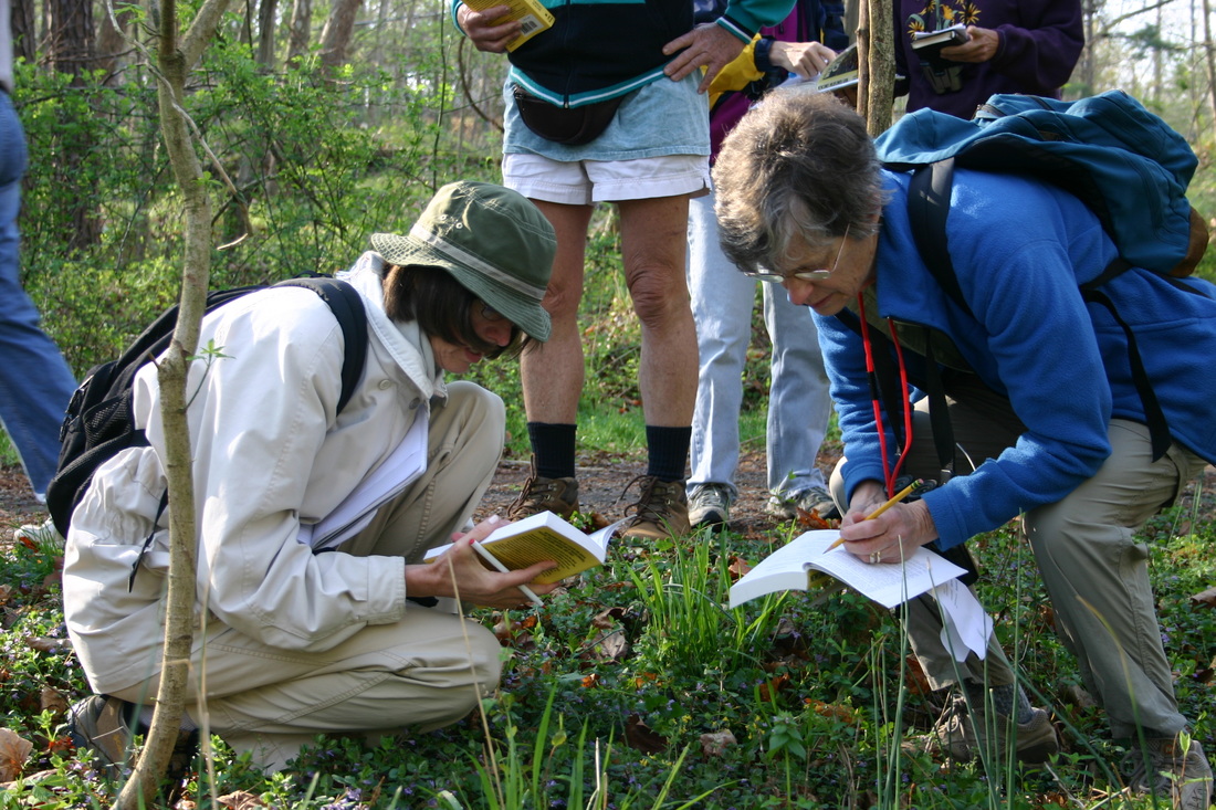
PictureVMN volunteers from the Rivanna Chapter identify wildflowers on a field trip.

We are now recruiting Virginia Master Naturalist volunteers for roles within a new collaborative project among the VMN program, the Virginia Department of Conservation and Recreation’s Natural Heritage Program, and the Virginia Native Plant Society.  

Project Overview
Project RareQuest is a pilot project to involve trained Virginia Master Naturalist volunteers in monitoring occurrences of rare species of plants and animals, many of which have not been seen in many years.  It is a partnership with the Virginia Department of Conservation and Recreation’s Natural Heritage Program, and it is funded in part by the Virginia Native Plant Society. 

Project Purpose
VDCR has a database of more than 9,000 occurrences of rare species across the Commonwealth.  They are called EOs (element occurrences) and include plants as well as animals.  These EOs need to be monitored on a regular basis to check on their status.  With so many sites and occurrences, VDCR can really use the help of talented Virginia Master Naturalists to get the job done.  

How It Works
Participating volunteers will receive training, either in-person or online, on the project.  Next, they will be assigned particular EOs in their region to monitor.  Most sites are on private land, so part of the project involves contacting the landowners ahead of time to request permission to visit the sites.  Volunteers will only need to visit each site once, find the species (if it is present), and document a few basic characteristics of the site and population.  Data will be collected by VDCR using an online application.

Sign-Ups

  • If, after reading through this entire project description, you are interested and qualified to serve in one or more of the volunteer roles, we ask that you complete the signup survey available at http://bit.ly/1JAw8Bx no later than Wednesday, June 24.  
  • We will use this survey to get volunteers matched with one of the training options (see below), to group volunteers into teams so that all the volunteer roles are covered, and to assign volunteers to sites and occurrences to monitor.  
  • If we have more volunteers than we are able to accommodate this year, we will make assignments based on interest in the various volunteer roles, geographic location, and skill levels.


Why Participate

  • Participating volunteers will have the opportunity to visit sites not normally accessible and see rare species.
  • They will be recognized in newsletter articles and scientific reports relating to the project.  


Training
We will have two training options for this project.  


Training Option 1: VMN Regional Conferences (cost = approximately $50, which includes the entire day of workshops and sessions as well as lunch)

  • We will offer a 2.5 hour training for this project at each of the VMN regional conferences.  
  • Chris Ludwig (VDCR) and Tom Smith (VDCR) will go over the volunteer roles, provide training in the data collection app, and lead a practice session with the volunteer protocols.  
  • We have space for 25 volunteers in each session, and we highly encourage volunteers who are qualified for and interested in one or more of the volunteer roles below to attend.  
  • If you complete the sign-up survey (see Sign-Ups, above) and are chosen to participate in this project, then we will contact you with additional information on how to register for the VMN Regional Conference in general and this session specifically.
  • Information on the dates and locations for the regional conferences and on which chapters are contained in each region is at http://www.virginiamasternaturalist.org/home/dates-and-venues-of-regional-conferences-announced.    

Training Option 2: Webinar (cost = free)

  • We will offer a series of 2 or 3 webinars that cover similar material as the in-person training, minus the hands-on practice.  These will take place during Fall 2015, and they will be recorded so that volunteers may participate live or watch them later.


Volunteer Roles
Please note that a single person could serve in multiple volunteer roles.  This list covers all the five functions that must be completed for the project to be successful.

Plant Identifier
Duties

  • Using the maps and information provided by VDCR and following provided protocols, visit known species occurrence locations, look for the target species and populations, and document presence/absence and health of the population.  

Skills Needed

  • Basic pl
    ant identification skills.  As a test of basic botanical skills, the Plant Identifiers should be able to answer the following questions:

  1. What are the two most common types of Lady’s Slippers found in Virginia, and what are two ways you can tell the two species apart?
  2. Name five Virginia maple species including the one with divided leaves.
  3. Name a plant of the Virginia mountains and one from the Coastal Plain.

  • Ability to read a map and use it to navigate to a specific location.


Bird Identifier
Duties

  • Using the maps and information provided by VDCR and following provided protocols, visit known species occurrence locations, look for the target species and populations, and document presence/absence and health of the population. 


Skills Needed

  • Bird Identifiers do not need to be expert birders, but they should have basic skills.  As a test of basic birding skills, the Bird Identifiers should be able to answer the following questions:  
  1. What are the differences between the Northern Loggerhead Shrike and the Northern Mockingbird?
  2. Where would you look for a breeding Morning Warbler in Virginia?
  3. Name 6 woodpeckers of Virginia.

  • Ability to read a map and use it to navigate to a specific location


Butterfly Identifier
Duties

  • Using the maps and information provided by VDCR and following provided protocols, visit known species occurrence locations, look for the target species and populations, and document presence/absence and health of the population. 

Skills Needed

  • Butterfly Identifiers do not need to be experts, but they should have basic skills.  As a test of basic butterfly identification skills, the Butterfly Identifiers should be able to answer the following questions:

  1. How do you distinguish the Black, Pipevine, and the black form of the Eastern Tiger swallowtail from each other?
  2. Name one of Virginia’s adult-overwintering butterflies.
  3. How can you tell a butterfly from a moth?


Data Wrangler
Duties

  • Using the software provided by VDCR and following provided protocols, upload data on occurrences.  Ideally, this is done in the field using a smart phone or tablet with cellular service, but it can be done after the field visit using a computer.  

Skills Needed

  • Data Wrangler volunteers should be comfortable with computers and mobile applications, and they should feel confident about learning new software and apps.


Landowner Liaison
Duties

  • Using the landowner information provided by VDCR and following provided protocols, contact the landowner to request permission for the volunteer team to visit the site.  Follow up with the landowner to let him/her know the status of the occurrences.  

Skills Needed

  • Landowner Liaisons should be good communicators, confident about making phone calls to people they haven’t met, and good at making people around them feel comfortable.


Now Recruiting VMN Volunteers for RareQuest Project Read Post »

Scroll to Top