–By Jim Parkhurst, Associate Professor of Wildlife Science and Extension Wildlife Specialist, Virginia Cooperative Extension
Populations of feral swine have become established in several areas of Virginia (e.g., Lee, Wise, Culpeper, Orange, Chesapeake), often bringing devastating effects on agriculture and private property; however, these are the populations that we know about and have been working to reduce. It’s the ones that we don’t yet know about that have been springing up in new areas and often at some distance from the closet known spots that are most worrisome and of greatest interest in discovering. These new populations often are the result of individuals illegally trapping hogs and releasing a small number of founding hogs in secluded areas with the intent of establishing new populations to hunt. Although some of this illegal trapping is occurring in areas associated with a known population here in Virginia, it’s much more worrisome that animals captured outside of Virginia, ones that potentially may be carrying parasites or diseases not found here, have been brought into the state and released; this can have substantial economic and/or biological implications. Much of this recent nefarious activity has been suspected along our border counties with North Carolina, but there are other suspect “hotspots” of new activity elsewhere in the state as well. Therefore, we are asking for the public’s help in bringing any new sightings of hog activity to our attention so that confirmation of presence can be confirmed and feral swine problems can be nipped before they become a threat to commodities, property, and public safety.
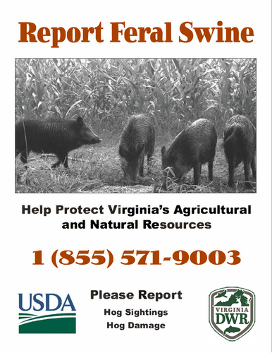
We are asking that you download copies of the attached flyer provided by Virginia’s USDA-Wildlife Services office and post them in prominent and highly visible locations where members of your community will see them. Reporting is being conducted through the Virginia Wildlife Conflict Helpline and thus all reports are anonymous and do not require any identification … the priority intent is to identify new areas of hog activity that can be surveilled, either confirm or refute presence, and, where confirmation is determined, devise appropriate means to administer proper treatment.
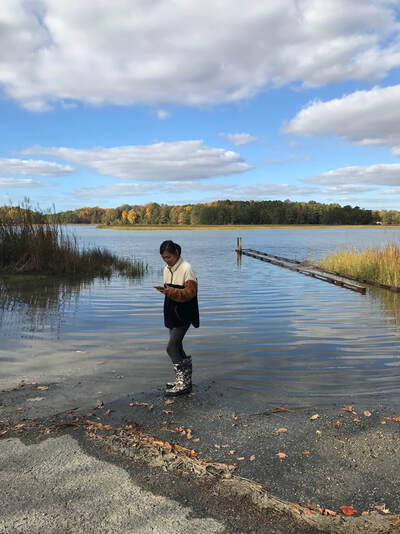
 Middle Peninsula Master Naturalist Rose Sullivan mapping the high tide line during the 2022 Catch the King event. Photo by Susan Crockett, MPMN.
–By Karen Duhring, Marine Scientist, VIMS CCRM
Catch the King is an annual volunteer event to collect flooding data during the highest tides of the year, known as the King Tides. The 7th annual Catch the King event will take place throughout coastal Virginia from Friday, October 27 to Sunday, October 29, 2023. The information collected is used by emergency managers and others who need detailed flooding data at street level.Catch the King mappers include many Virginia Master Naturalists from coastal chapters. Some are veteran Tide Captains helping recruit volunteers, lead practice mapping sessions in their region, and serve as point of contact for their team before, during, and after the event. More Tide Captains are needed.
As the group of flood mappers continues to expand, so does a network of informed and active citizens who can crowdsource flooding events and bring a larger group into the conversation, helping move solutions to reality.
How You Can Help:
• Visit the Catch the King 2023 website, hosted by Wetlands Watch.
• Learn about the free Sea Level Rise app available for download
• For inquiries about Catch the King, contact Gabi Kinney, Wetlands Watch Community Engagement Project Manager
• Find out if Catch the King is an approved project for your chapter. Assistance with a VMN project proposal is available by contacting Karen Duhring at VIMS.
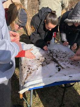
 Volunteers conducting water quality monitoring by counting invertebrates collected. Photo by Monica Hoel.
DEQ is now accepting applications for Citizen Water Quality Monitoring Grants. Applications must be submitted by Aug. 31. Updates this grant cycle include changes to the application package format and an expansion of Coordination Grant eligibility. These grants can be used to purchase water quality monitoring equipment, train volunteers, pay for lab analysis costs, and promote stream monitoring efforts in locations where DEQ is not currently collecting water quality samples.
From 2015-2020, citizen monitoring data was used to assess 3,174 miles of streams/rivers, 64 square miles of estuary, and 33,347 acres of lakes!
For more info, visit the citizen monitoring webpage, email citizenwater@deq.virginia.gov or call Meighan Wisswell at (571) 866-6494.


