Catch the King Tide Flood Mapping Event
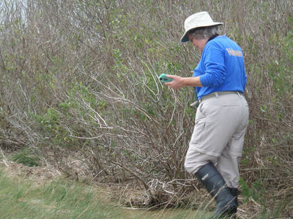 Peninsula VMN volunteer Susan Crocket collecting GPS points along the high tide line in Gloucester County during the Catch the King Tide event. Photo by Rose Sullivan (VMN-Peninsula Chapter).
By Karen Duhring, Virginia Institute of Marine Science
Several VMN volunteers from coastal chapters participated in a citizen science crowdsourcing event called ‘Catch the King Tide’ on November 5, 2017. King tides are the very highest tides predicted to occur each year based on the positions of the earth, sun and moon and their gravitational effects. Coastal communities around the nation have launched projects to document how high the king tides rise as they prepare for the effects of sea level rise.
Today’s king tides are expected to be the normal, everyday tide levels as the sea level rises over the next few decades. Mapping the extent of today’s king tides will help coastal residents understand which community areas are the most vulnerable to more frequent tidal flooding. Many neighborhoods already experience frequent ‘nuisance flooding’ when cars have to be moved from driveways and normal traffic routes must be altered to avoid flooded roads.
VIMS and Old Dominion University scientists are working with emergency managers and other partners to build models that predict flood levels as real storms approach. These models are based on topography data obtained from air-borne radar equipment that sometimes misses tidal creeks and waterways flowing underneath the tree canopy or through culverts under roads. The predictive models can be improved with more accurate locations of tidal flooding to then understand how tidal flooding interacts with heavy wind and rain during storms.
The Catch the King Tide crowdsourcing data collection event was organized to map the location of tidal flooding during this extreme high tide event simultaneously across the Hampton Roads region from Gloucester County to Virginia Beach. Over 600 volunteer citizen scientists participated, including 25 VMN volunteers from 3 chapters (Tidewater, Peninsula, Historic Rivers). They received some basic training and used a special Sea Level Rise app on their smartphones to collect GPS points as they walked along the high tide line. Some of the VMN volunteers also served as Tide Captains to coordinate regional and neighborhood groups.
If you want to join this citizen science project, you can download the Sea Level Rise app from the Sea Rising Solutions web site. Learn more about ongoing and upcoming mapping events from the Catch the King Tide Facebook page and a VIMS interactive story map. The Commonwealth Center for Recurrent Flooding Resiliency web site has additional general information about tidal flooding, sea level rise, and what Virginia’s coastal communities are doing to adapt to these challenges.
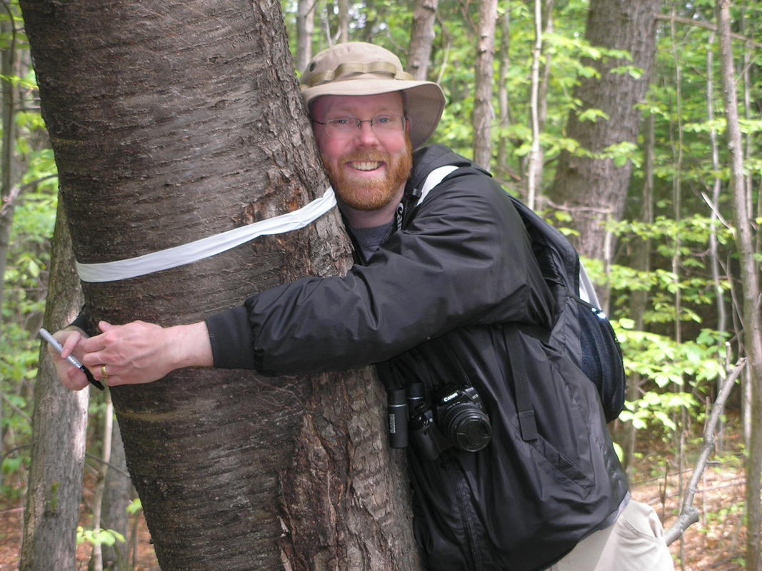 There are a lot of reasons to love urban forests! Photo of Eric Johnson, VMN-Riverine Chapter, taken by VMN-Rivanna Chapter
Upcoming Urban Forestry and Related Continuing Education Opportunities
One of our VMN program funders this year is the Virginia Department of Forestry, via an Urban and Community Forestry grant, which comes from federal funds from the US Forest Service. As part of our grant activities, we are working to share more opportunities for VMN volunteers to learn about urban and community forestry topics. Here are some events from our sponsors and partners coming up this spring that can help you learn about the importance of urban forests, how to manage urban forests and small acreage forests, and more.
Day-long Events
Virginia Woods and Wildlife Conference
This all day conference is not specifically focused on urban forests, but it is for owners of either large or small tracts of land. It is a one stop/first stop for individuals, families, and managers to learn about woods, wildlife, and other natural resources. It provides multiple links to information, sources of assistance and a better understanding of the natural resources around you. It will explore a myriad of forest issues relevant to owners of woodland.
February 24, 2018, 8:30 am -4:30 pm, Germanna Community College, Culpeper. Registration deadline is February 14!
More information and registration
Roanoke Tree Health Care Workshop
Topics at this event include managing old trees, tree planting, community engagement for preserving trees and understand tree root system.
March 7, 2018, 8:00 am – 4:00 pm, Virginia Western Community College, Roanoke.
More information and registration
Northern Virginia Urban Forestry Roundtable
How Do We Know Trees We’ve Planted Are Surviving and Thriving? In addition to local knowledge, experience and connections (i.e., the heart of the Roundtable), this event will also feature a guest who has studied this issue extensively. Lara Roman, PhD, US Forest Service Research Ecologist will present studies of how other jurisdictions throughout the nation deal with limited staffing and budgets to monitor their trees survival and growth.
March 15, 2018, 9:30 am – 2:00 pm, Wetlands Studies and Solutions LLC, Gainesville.
More information and registration
Online Courses
Woodland Options for Landowners
This is a twelve-week self-paced online course
that begins Monday, February 12 and ends April 30, 2018. The course objective is to provide an introductory level understanding of basic forest management principles and techniques and to help participants use this understanding to become better land stewards. While not focused on urban forests or small acreage solely, the course is open to landowners of any acreage as well as interested citizens and volunteers.
More information and registration
The Woods in Your Backyard
Registration is now open for the Spring session of “The Woods in Your Backyard” online course. This self-paced, non-credit course runs 10 weeks from March 7th to May 20th, 2018. The course will help landowners convert lawn to natural areas and enhance stewardship of existing natural areas. Based on the guide of the same name, the course provides strategies to landowners of small parcels of land (1-10 acres) that improve the stewardship of their property for personal enjoyment and environmental quality. It uses a hands-on learning approach to help participants develop and implement a plan for their property. Activities include how to map habitat areas, understand basic ecological principles about woodland and wildlife, choose and implement a few habitat management projects, and how to set a timetable and record your progress. Online discussion groups will allow participants to interact with others taking the course. A certificate of completion is awarded when all assignments are completed.
More information and registration