Collaborators in this project include learning scientists, ecologists, and computer and information scientists from several higher education institutions, including Rutgers University’s Program in Science Learning, Virginia Tech’s Department of Forest Resources and Environmental Conservation, Colorado State University’s Natural Resource Ecology Laboratory, the University of Massachusetts, and Virginia Master Naturalist volunteers.
The results from this project will help to build and assess a collaborative science learning system as a tool to teach citizens about authentic scientific inquiry and how these citizens can become citizen scientists by engaging in authentic and necessary scientific practices.
Below, we share examples of some of the Collaborative Science projects VMN volunteers are leading.
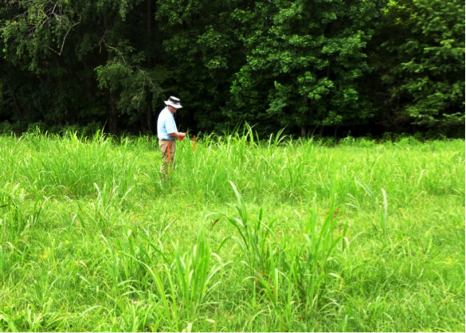
 Staking out the study site. Photo from VMN-Blue Ridge Foothills and Lakes Chapter.
Text by Rick Watson, Blue Ridge Foothills and Lakes Chapter
The Blue Ridge Foothills and Lakes Chapter recently launched a Collaborative Science project at Booker T. Washington National Monument (BTWMN). Project volunteers will localize and eradicate invasive grasses, e.g., Johnson grass, from a 15 by 30 meter area within a primarily fescue grass field at BTWNM. Efforts will involve spot herbicide treatments in mid/late summer, followed by restoration planting in that area with three different mix types of native grasses (e.g., Big/Little Bluestem, Switch grass, Indian grass) in the fall. Spring and summer growth will then be assessed by volunteers in May and September of the following year. The goal is to determine which native grass mix, if any, competes most effectively with, and thereby deters, the Johnson grass invasive, thus providing park personnel with key information on how they might restore the monument fields to ecological conditions typical of those in the late 1800s.
A mini-grant, courtesy of the National Science Foundation project, is covering herbicide, seed, and other materials costs. Twelve volunteers participated in an online facilitated web-based building of a project model that successfully highlighted all the elements that could impact the project plan. This model, along with key technical guidance from the BRFAL Chapter Advisor, was used to guide the detailed project plan design. The site was assessed and a proposed study area approved by BTWNM management. The test area was then marked off and staked and the first herbicide treatment conducted July 15th. Results from the study will be documented in the Collaborative Science website, where others may learn and apply it.
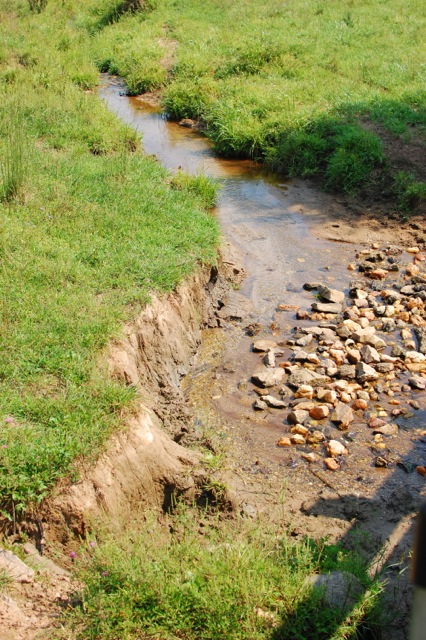
 Degraded stream at Bundoran Farm, prior to the project activities.
Text by Mary Tillman, Rivanna Chapter
Rivanna Master Naturalists on Bundoran Farm wanted to improve the water quality in the Chesapeake Bay by improving water quality in their own back yard, the Middle Branch of the Hardware River.
A year ago when we joined a training on collaborative science, we decided to apply what we learned to Bundoran Farm, a 2300 acre preservation development where the goals are to use best practices in protecting the environment, maintaining the viewshed, and preserving farmland. Cattle, horses and sheep graze on the extensive pastures which allows Bundoran to fulfill its mission to support agriculture. Unfortunately the cows also use the streams to cool themselves and to defecate. The run off from the pastures as well as livestock contamination of the streams has contributed to water pollution in both our watershed and ultimately in the bay. It stood to reason that if we could deny the animals direct access to the streams and provide them with an alternative water source we might be able to eliminate sources of pollution here on the farm as well as throughout the larger watershed. The collaborative training helped us do just that.
The training taught us how to develop and implement solutions to problems in a new way. Rather than creating an outline where one step follows another, we learned to think more dynamically, not censoring or ordering in a linear way, but freely generating all obstacles or challenges that we thought we might encounter. Instead of making lists we wrote these obstacles onto balloons or satellites that rotated around a core where we had written a brief statement of our project. In our case it was “fencing livestock out of streams.” We also connected obstacles that were related.
Bundoran Farm has many individuals and groups who needed to support the project if we wer
e going to be successful. They were the homeowners who would be affected by the fencing of their property, the farmers who used the land for their livestock, the employees who worked for the developer, the Farm Management Committee who would ultimately recommend either for or against the project to the Board of Directors, and the developer himself. Each of these groups received their own balloon in the planning process and had to be approached differently in order to get them on board. In addition to the groups with vested interests in the project, we had other obstacles to overcome.
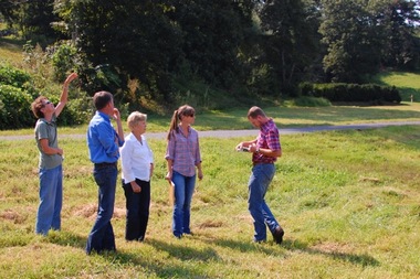
 The Bundoran Farm Collaborative Science team checks out the site.
Another concern was how we would demonstrate that our project really did improve water quality. We did this by teaching ourselves to test for E. coli bacteria. We used James Beckley’s presentations on You Tube as a learning tool, bought the materials we needed, and set up and implemented a schedule for testing.
Probably the most important consideration was funding for the project. We worked with the Thomas Jefferson Soil and Water Conservation District whose aims were similar to ours, and we became one of their largest projects. Besides providing the fencing, piping, water troughs, gates and a well, they drew up a fencing plan that encouraged farmers to rotate their cattle on a more regular basis. Bundoran Farm benefitted from a TJSWCD grant that covered 100% of the costs.
When we completed our fencing project, we were left with 35 feet of pasture on each side of the streams that was no longer available to cattle. This riparian buffer, required by the project, helps to filter impurities out of the streams as they flow though the farm. The presence of the buffer has given us a unique opportunity to create an educational trail that follows the stream through a variety of habitats—open pasture, a fresh water marsh, woodland and a lake. Each habitat attracts different kinds of flora and fauna throughout the year. What we want to do now is build a trail that makes use of the buffer to educate the residents of the farm, school groups and Master Naturalists. We hope to use the collaborative science model to help us realize this next goal.
